Take a “Trip” with a Cool New Google Maps Feature
Google Maps is one of my go-to tools when traveling, and I just learned of a super cool new feature they’ve added.
Rather than being confined to looking at familiar oceans and peaks, you can now explore….Space!
Google in conjunction with Nasa now offers planets, icy moons, and even an International Space Station to “travel” to via a Google Maps space feature.
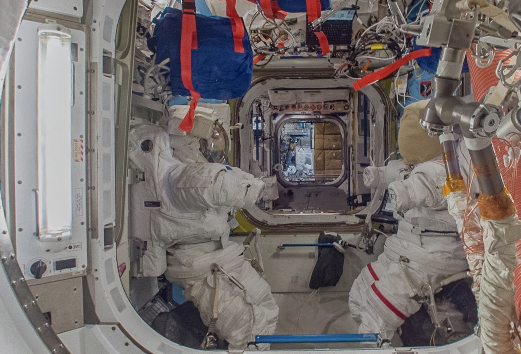
I pulled up the International Space Station, and found that I could catapult my way through the tunnels by using the arrow functions. My trip was solo, but as I clicked on information points throughout the journey they helped me understand what I was looking at.
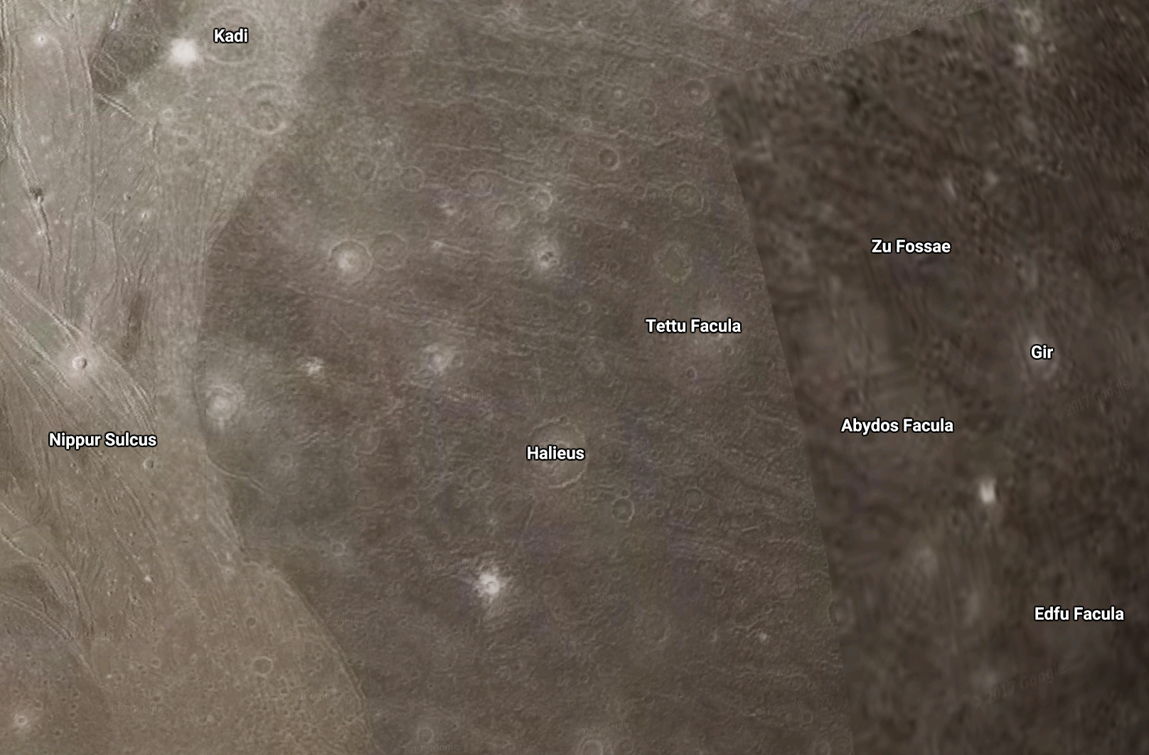
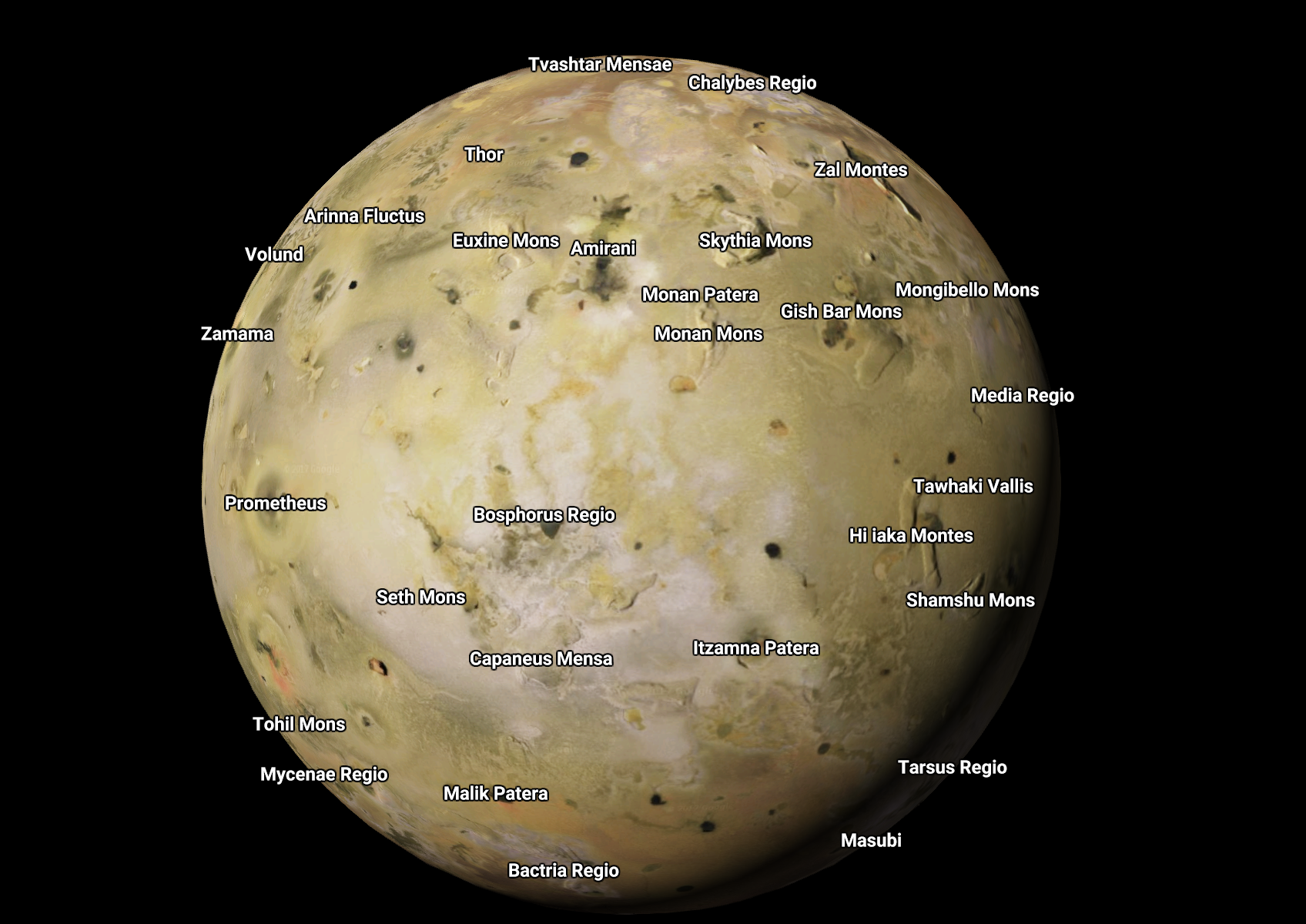
After looking over the moons, I pulled up Ganymede, the largest moon of Jupiter. I zoomed in to find unfamiliar topography and places such as Tettu Facula that seemed to be straight out of a Star Wars movie.
Here are all of the places you can explore via Google Maps (with links to each):
Mercury
Venus
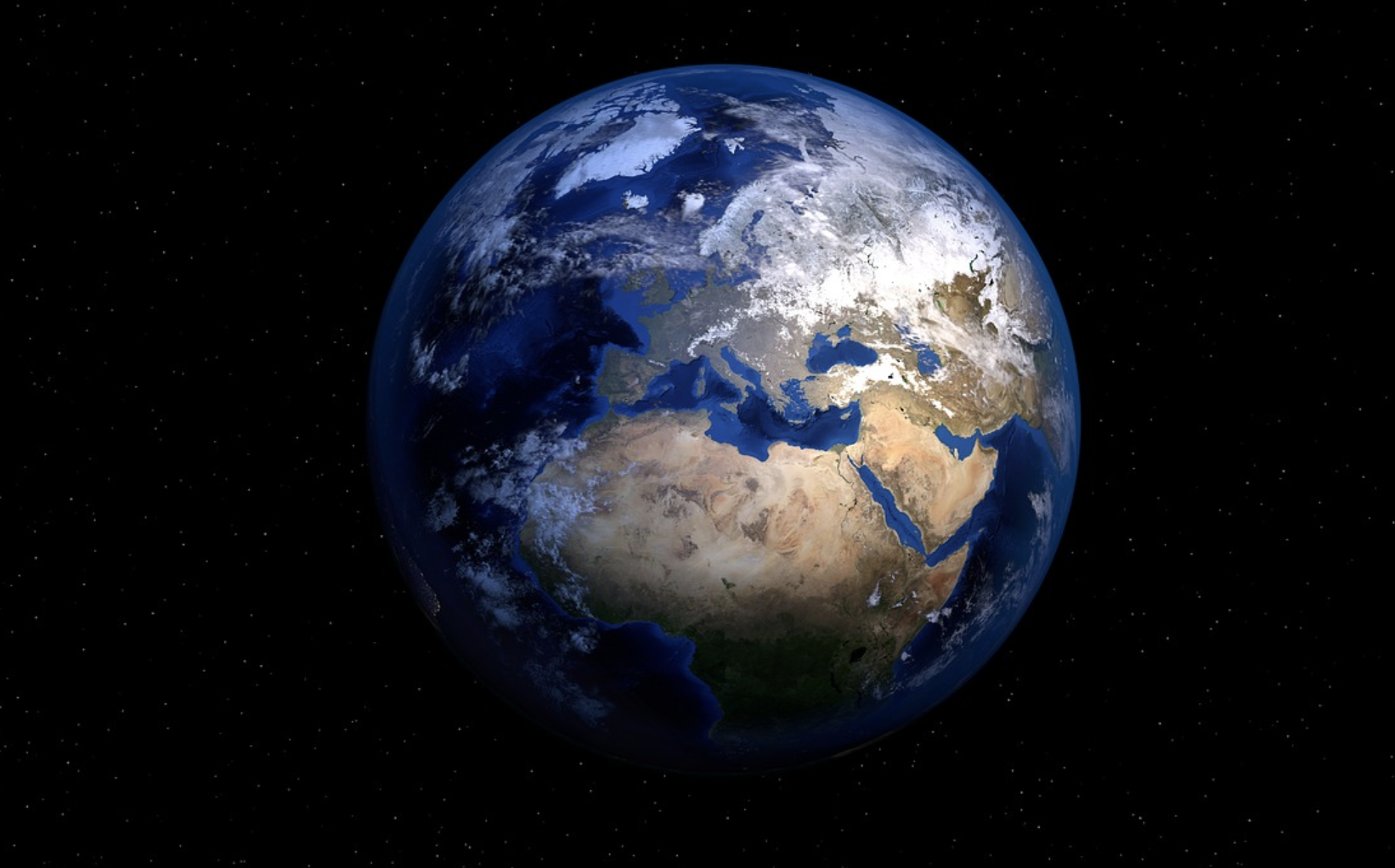
Earth (Duh!)
International Space Station
Moon
Mars
Ceres
Io
Europa
Ganymede
Mimas
Enceladus
Dione
Rhea
Titan
Iapetus
Pluto
Here’s a link to the new Space feature.
You can plot out vacations for your great-great-grandchildren, or just get some alternate pet names, like Meng-P’o Macula (located on Pluto).
Obviously, the options for these new places are limited and you won’t find any bicycle routes or traffic like you would on good ‘ol Earth.

There is also no search feature just yet so if your kiddo learned about a place in school and you want to find it on the map you’ll have to do a lot of zooming and spinning via your mouse to rotate things around.
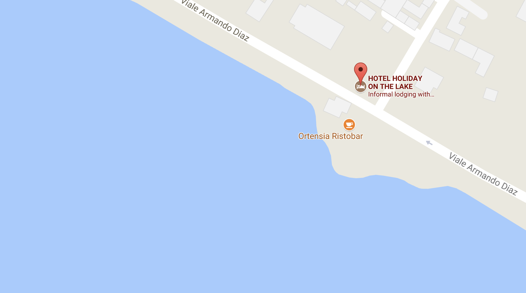
Back in today’s world of 2017, I find Google Maps to be very helpful to figure out in advance if a hotel is really situated by a lake as advertised, for example, or if it is several blocks away with better options closer. I also use it to find out what restaurants are in an area around me (especially outside of the US when Yelp doesn’t always accurately display all the options).
Of course, Google Maps offers turn-by-turn directions and even offline directions. If you love Google Maps as much as I do but haven’t yet used it offline, fellow blogger Jeanne with Le Chic Geek has easy step-by-step directions here. Offline (and online) directions aren’t always perfect, as I discovered on a trip in Greece where I ended up at a tiny church hidden in the hills rather than the huge popular tourist attraction I was looking for. In some countries, Google Maps doesn’t offer realistic routes, and will tell you to turn left where there is a field of goats or a wall. In those instances I use Waze to navigate the streets.
Maybe someday we’ll actually holiday on another planet, and in the meantime this cool Google Maps feature will give us some inspiration.
